8.1 Access to Results
There has been wide spread interest in the results of the Level One Survey from a large number of organisations in Cambodia. Among these organisations technical and practical capabilities to use information such as the survey offers is extremely varied. Some organisations have active information management departments with access to database management systems and geographic information systems. Others have access to personal computers with spreadsheets and simple data management software while still others are content to work from hard copy maps and statistical reports. What was needed was a simple tool that would enable the full range of users to create for themselves the reports they require on their personal computer.
Database Manager, Dr. Reto Gass, had built a variety of user applications around the same software package used for data entry. This is FoxPro for Windows, which is freely available. Over the second half of 2001 this application took shape and was demonstrated to a wide range of users. Based on their observations and suggestions the range of the application was steadily refined, expanded and developed. Towards the end of 2001 the project gave a copy of this application and the survey information entered in the database at the time, to officers in the Planning Division of CMAC. In early 2002 this application was also made available to the two international specialists working at CMAA for their evaluation. In April 2002, the digital version was given, with permission of CMAA, to the Battambang LUPU to assist with their annual planning activities. After discussions with CMAA it was decided that all other data requests would be satisfied through the provision of hard copy reports produced by the database unit
(see Annex of L1S Clients).ĀThese requests were the basis from which a standardized set of reports and maps have been produced
(See Standard Reports and Maps Section). These maps and reports can be easily generated for the country and for all provinces, districts and communes in the country. Nonetheless, meeting the diverse needs of all potential users of the survey information is a resource intensive activity. In January 2002 an agreement was made with CMAA to second their key database specialist, Mr In Channa to the Survey Database Unit to learn in depth about the structure and organisation of the database and to assist the survey in disseminating survey results. He worked on creation of standardised and custom products to meet the needs of end-user organisations. At the conclusion of the survey Mr In Channa returned to the Database Unit at CMAA.
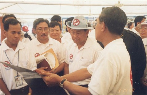
From right to left - Prime Minister HE Samdech Hun Sen (holding map portfolio) discusses
results with Khem Sophaon, Director General of CMAC (center wearing hat)
and HE Sam Sotha, Secretary General of CMAA.
A number of the requests received have been extremely complex or require decisions to be made
as to the importance of various conditions or criteria when setting up the query.Ā In these cases it becomes essential to work closely with the organisation submitting the request to
ensure their needs are adequately met.ĀThis is at times an exceptionally time intensive activity for both parties.ĀThe preferred option would be to provide an overview of the system to the user and a copy of the application such that the organisation can run queries and produce reports as desired or needed.Ā
The application will run on any PC running Windows 95 or later versions, requires about 60MB of space on the hard drive and requires about an hour to understand its range of functionality and how to operate it.
There are contains eight modules enabling the user to generate the following reports and queries.
|
No.
|
Subject
|
Description
|
Output / Results
|
|
|
|
|
|
|
1
|
Query Villages
|
Selects villages by filtering village and its
accumulated area data. Filtering is available for any essential village
characteristic and for any geographic area.
|
Ę
List of villages
Ę
List of villages with associated key information
Ę
List of villages in GIS readable format
|
|
2
|
Query Suspected Areas
|
Selects suspected areas by filtering area data.
Filtering is available for on any essential area characteristic and for any
geographic area.
|
Ę
List of suspected areas
Ę
List of suspected areas with associated key
information
Ę
List of suspected areas in GIS readable format
|
|
3
|
Statistical Profiles
|
Statistical information on survey, demographics,
poverty, contamination and impacts for any selected geographic area from
nation to village
|
Standard statistical report with a breakdown of key
figures for the next lower administrative unit.
|
|
4
|
Area Profiles
|
Summary Information for the selected suspected area
and its associated villages
|
Standard summary report
|
|
5
|
Victims / Casualty Reports
|
Summarizes victim information for any selected
geographic area from nation to village
|
Standard report on victimsÆ numbers, annual
incident rates, animal casualties and victim names with associated bio-data
|
|
6
|
Survey Statistics
|
Standard summary statistics for nation or any
selected province
|
District, commune, village numbers, changes to the
gazetteer and contamination found.
|
|
7
|
SAC Scoring Report
|
Impact scoring defined by Survey Action Center
(SAC) recommended methodology for selectable geographic areas (nation to
commune).
|
Number and percentage of villages in no impact,
low, medium and high categories for the selected geographic area
|
|
8
|
User Scoring Report
|
Impact scoring defined by User for selectable
geographic areas (nation to commune).
|
Number and percentage of villages in no impact,
low, medium and high categories for selected geographic area
|
The application allows access to sketch maps of suspected areas, but it does not provide access to digital maps of the country for the display of locations of results. However advanced users can link the report files created, using GIS software, to their digital map files. File format is in .
dbf format. Two types of geographic references are provided in the reports:
- Point references (as UTM coordinates) for villages and benchmarks, and
- Polygons for suspected areas.
A great variety of applications are possible using ArcView GIS, including for example:
- Display of any village as a point on a map and classified (by symbol size and colour) for any attribute, or combination of attributes of villages in the database,
- Display of suspected areas (as polygons) classified by colour based on attributes associated with the area, and
- Combinations of point and polygon displays to show, for example, proximity of villages to suspected areas.
Verification of reports is available as the original data set can be accessed using the
application.
On-line help is available for setting up scoring weights for modules, #7 and #8.
The database and the application are available on CD; the village sketch maps are available on
two additional CDs.